Origins
The name Hook derives from the Old English word hōc, meaning a hook, angle, or nook of land. The name was originally applied to woodland in this area, describing land shaped like a hook between two tributaries of the River Whitewater. The earliest recorded spelling is Hoc in 1223. (Old Hampshire Mapped)
The earliest surviving written mention of Hook in historical documents relates to a land dispute in the thirteenth century, where a parcel of land is recorded as being located in "la Hoke". This form reflects the Norman French legal language used in medieval court records, with "la" simply meaning "the", while "Hoke" derives from the Old English word hōc, describing a hook-shaped piece of land or bend in the landscape. (Feet of Fines CP 25/1/203/5; original Latin document)
Although Hook does not appear by name in the Domesday Book of 1086, this does not necessarily mean the settlement did not exist at that time. Many smaller communities and localities were absorbed within larger manorial estates and only began to appear separately in written records as population increased and landholdings became more defined in the twelfth and thirteenth centuries. The court record therefore likely reflects the moment when Hook emerged as a recognised place-name in official documents, rather than the point at which the area was first settled.
For most of its history, Hook was not a distinct settlement but scattered farms and woodland within the neighbouring parishes of Odiham, Newnham, and Nately Scures. It was not until 1932 that Hook was formed into its own civil parish, carved from parts of these three neighbours within the hundred of Odiham. (Hook Parish Council)
Through the Ages
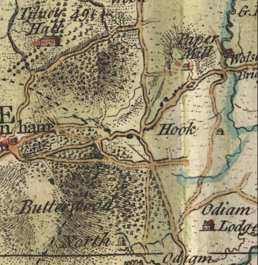
Hook's story is the story of a road. The route from London to the south-west of England — to Salisbury, Exeter, and ultimately Land's End — was one of the great arteries of Georgian Britain. Every day, stagecoaches thundered along this road carrying passengers, mail, and goods. And every few miles, they needed to stop: to change horses, to rest, to eat. Hook was one of those stops.
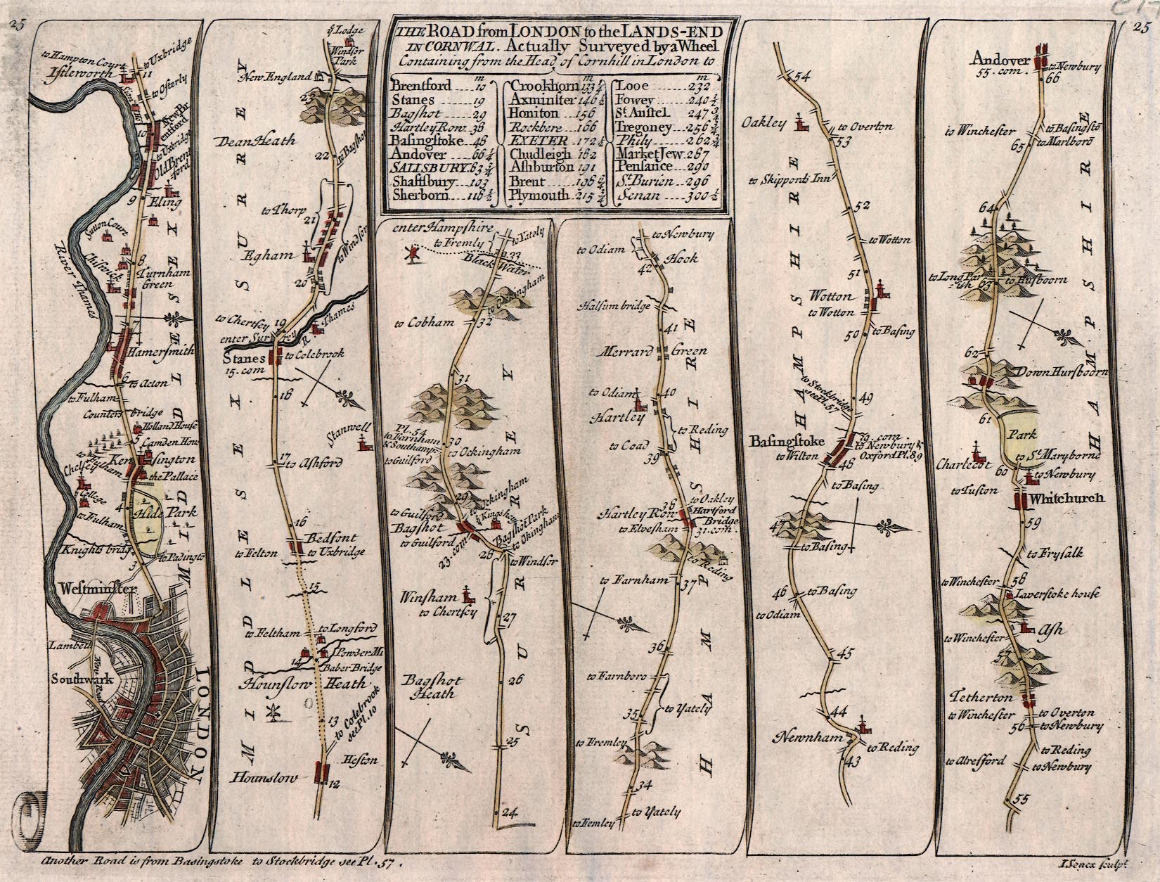
By the 18th century, coaching inns had appeared along the main street, offering fresh horses, food, and lodging to travellers making the long journey between capital and coast. In the late 18th century, a turnpike road was constructed to aid navigation of the steep Scures Hill to the west — part of a network maintained by the Basingstoke, Odiham, and Alton Turnpike Trust, established in 1736. The road improved, the coaches grew faster, and Hook prospered.
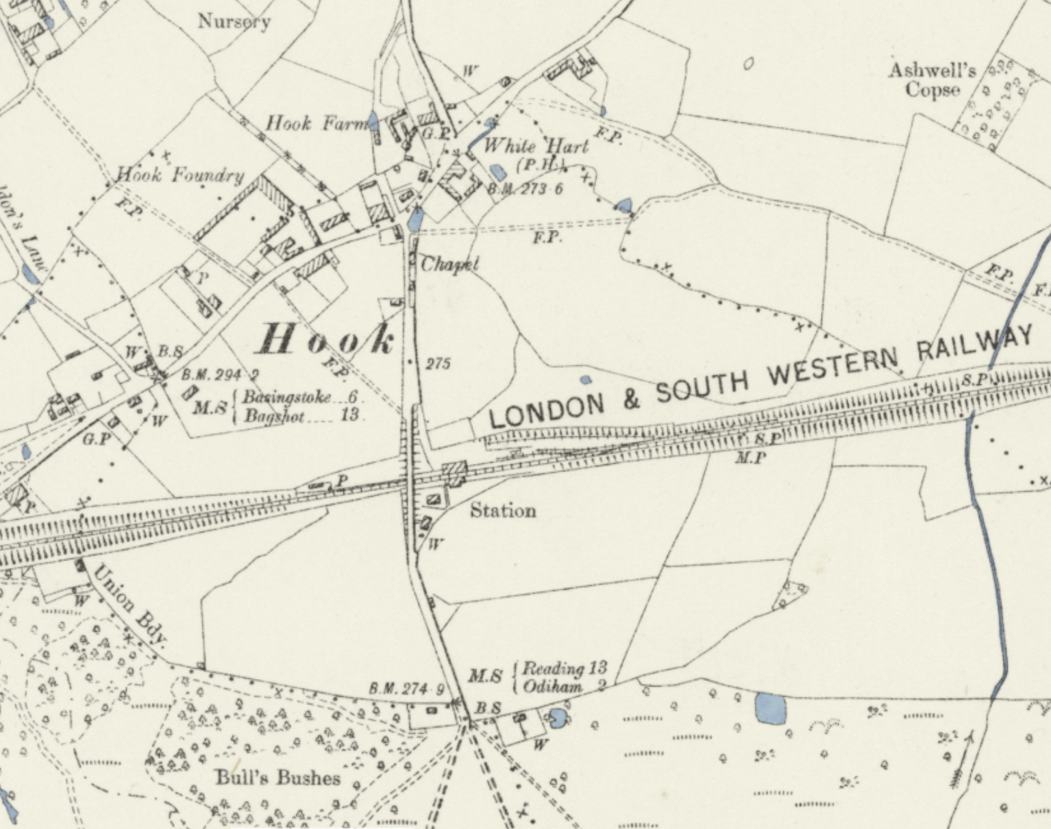
The railway changed everything. In 1839, a line was built through Hook on its way from London to Basingstoke, but there was no station. Local landowners campaigned for one, seeking better transport for timber and crops. Their campaign succeeded: Hook railway station opened on 2 July 1883, signalling the birth of the modern village. The coaches fell silent, their inns repurposed, but Hook had already learned the art of serving travellers — a skill it would carry into the commuter age.
Today, Hook sits between two worlds: close enough to London for commuters, rural enough to feel like Hampshire. The old coaching road is now the A30, but echoes of the past remain for those who know where to look.
The Realm Today
Walk through Hook now and you'll find a village that has learned to balance heritage with growth. The high street still follows the old coaching route, lined with a mix of Victorian buildings and newer additions. The railway station remains the village's connection to the wider world.
Look closer and the layers reveal themselves. Beyond the modern shopfronts, Hook's heritage persists in its railway station — the Victorian building that transformed this coaching village into a commuter town — and in Bartley Heath, a rare surviving fragment of Thames Basin heathland. These are the first of Hook's Enwella documented here, with more to follow as research continues.